Kakepuku 9B1D3B
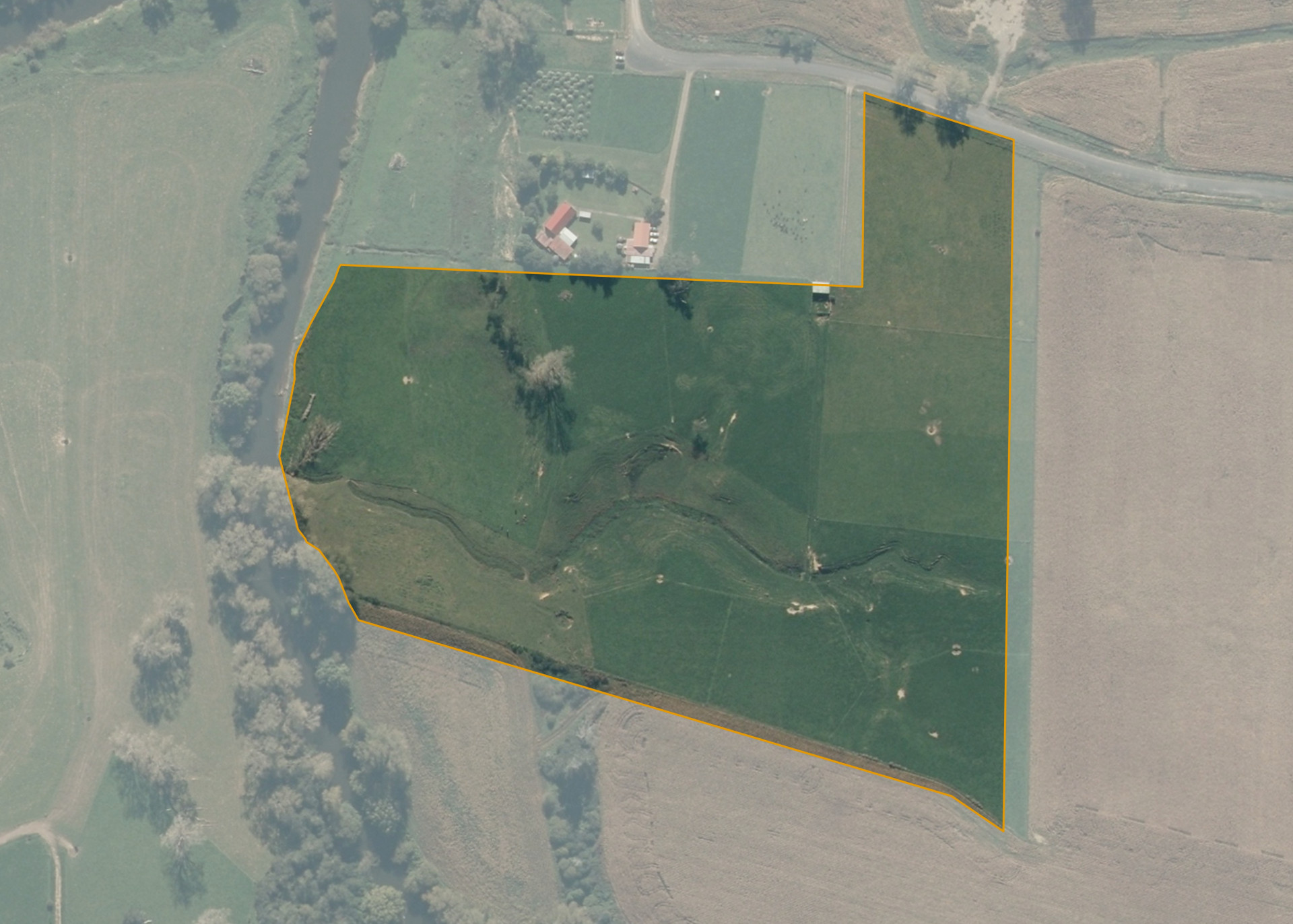
Kakepuku 9B1D3B is an 8.9031 hectare property situated on Morgan Road, Te Kopua and is approximately 13 kilometres north-east of Te Awamutu. The land is predominantly flat to easy hill in contour and adjoins the Waipa River on its western boundary. The block can be accessed from Morgan Road.
The effective area, approximately 8.8 hectares, is currently utilised for dairy support. The balance of the land can be attributed to the waterways and margins.
There is a barn and a set of cattle yards on the property.
Land Information
- Land area:
- 8.9031 hectares
- Location:
- Morgan Road, Te Awamutu
- Region:
- Waikato
- Māori Land Court region:
- Waikato Maniapoto
- Role of Māori Trustee for this whenua:
- Responsible Trustee
Learn more about the role of the Māori Trustee.
Owner Information
There are 39 people or whānau trusts who have shares in Kakepuku 9B1D3B.
Find individual owners or whānau trusts for this whenua
Tip: Search by first name
If you have a question about this whenua or you want to update your details please contact us.
Find out about upcoming owner hui for this whenuaStay connected with My Whenua
My Whenua is our online service for owners, trustees, whānau and those with a connection to whenua we look after on their behalf.
It’s a way to stay up to date with information about your whenua, including:
- Maps and photos
- Owner reports
- A list of owners
- Minutes of owner hui, and more.